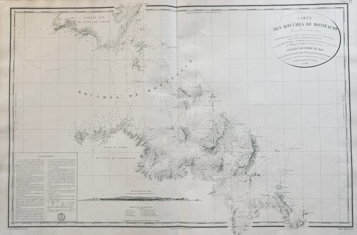
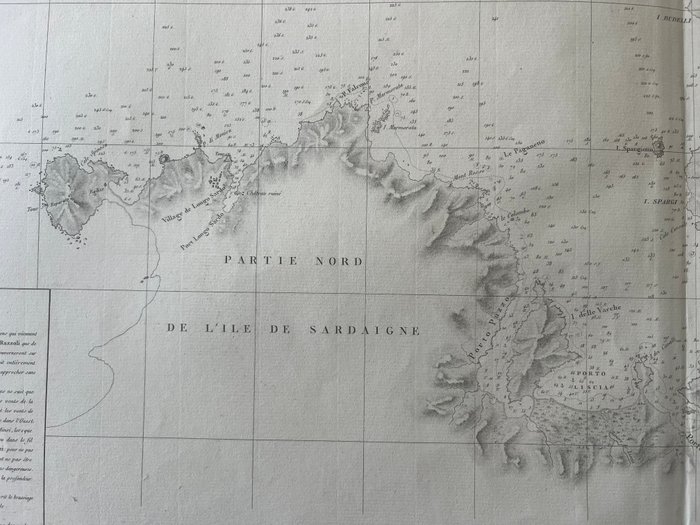
Europa - Frankrig / Corsica Island; Hell / Dépôt de la Marine - Corse - Sardaigne : Grande Carte Marine des Bouches de Bonifacio - 1821-1850

Detaljer
Beskrivelse
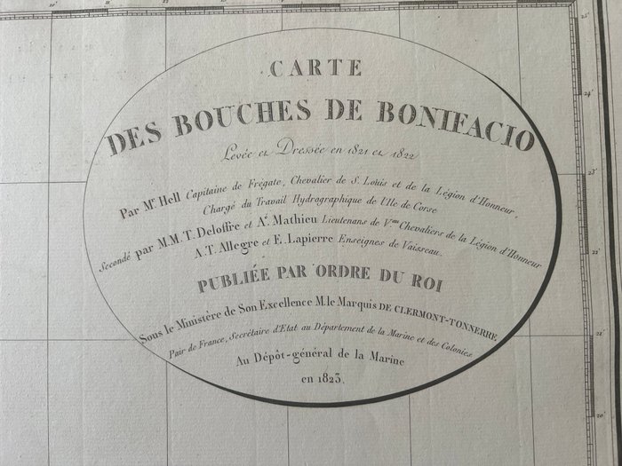
FOR helvede, skibskaptajn FLÅDENS ALMINDELIGE DEPOSITUM: 1823 SÅDEKORT FLÅDEDEPOT. - Kort over Bouches de Bonifacio. Udgivet: Paris, 1823 Stand: God almen stand. Central fold Kort over Bouches de Bonifacio. Opmålt og opført i 1821 og 1822 af hr. de Hell, kaptajn på fregatten, assisteret af hr. M. T. Deloffre og A. Mathieu. . .HAR. T. Allegro og E. Lapierre. Stemplet af flådens generaldepot En første undersøgelse af Korsika blev udført af fregatkaptajnen Hell fra 1820 til 1824 uden assistance fra hydrografiske ingeniører. Dens undersøgelse er baseret på den triangulering, som geografiske ingeniører udførte i 1791, og på deres matrikelkort. Kortet over Korsika blev offentliggjort i 1831. Det inkorporerer topografiske detaljer af kystlinjen fra et kort udgivet i 1824 af War Office. Suverænt originalt søkort på kraftigt papir, vanddybder er noteret HELVEDE - Pilot fra øen Korsika opvokset i årene 1820, 1821, 1822 og 1824 [] - Ingen placering; Ved flådens generaldepot, 1831 Dette meget sjældne Atlas består af 32 kort og præsenteres i meget sjældne offentlige udsalg.

