

Auktion
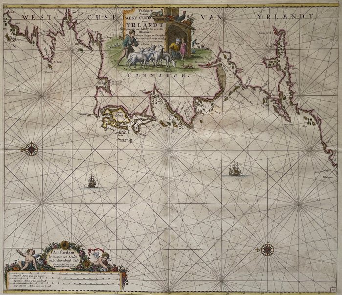
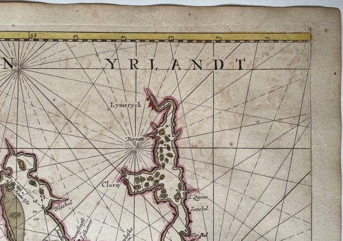
Irland - Irland vestkysten Ballehaique Limerick Galway Killibegs; J van Keulen - ‘Paskaart Vande West Cust van Yrlandt Beginnende van Klady Tot aen De Blasques’ - 1681-1700

1 EUR
Detaljer
Dato:
13/09/2024
Beskrivelse
Titel i en kartouche med en bondefamilie med får og høns øverst i midten: 'Paskort Vande Westcust van Yrlandt. Startende fra Klady til en De Blasques ... A0 forbedres fra mange fejl. 1682'. Aftryk: nederst til højre i en kartouche med putti 't'Amsterdam, Af Joannes van Keulen ... ' Derunder tre milepæle. Sidenummer nederst til højre: '19'. Fra: 'The New Great Shining Sea Torch, ...', Amsterdam, J. van Keulen, 1697-1709. Orientering: Øst ovenover. Kompasroser og skib til søs. God stand, komplet side (54x62 cm.) med brede marginer, på håndlavet papir med vandmærke 'HD', midterfold som offentliggjort, senere farvelægning, verso blank.
Antique Map West Coast of Ireland J. van Keulen 1697
Papir
KORT
Antal: 1
Størrelse: 54 x 62 cm
Relaterede produkter
Relaterede produkter
Relaterede produkter
Relaterede produkter
Relaterede produkter
Relaterede produkter
Relaterede produkter
Relaterede produkter
Relaterede produkter
Relaterede produkter
Relaterede produkter
Relaterede produkter

