World Map - Verdenskort; Bellin, Jacques Nicholas - An Essay of a New and Compact Map, Containing the known Parts of the Terrestrial Globe, 1750 - 1721-1750
Auction

World map by Bellin, 1750

catawiki
65 EUR

Details

Date:
14/11/2024
Farve:
Black, White

Description from the seller

World map by Bellin, 1750

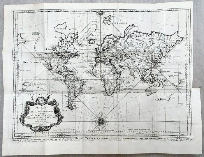
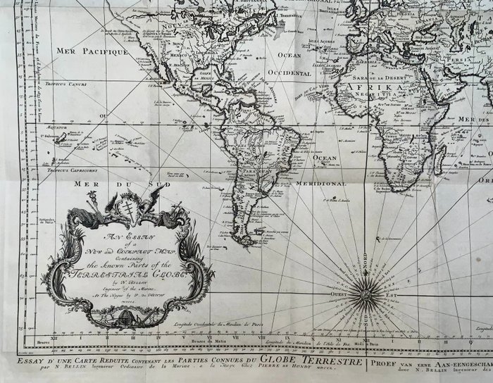
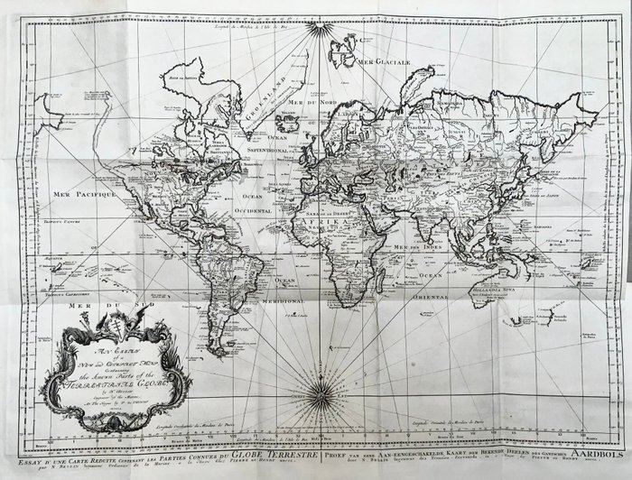
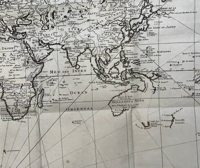
Bellin, Jacques Nicholas 1703-72 Et essay om et nyt og kompakt kort, der indeholder de kendte dele af den terrestriske klode ca 72,5 x 58 cm. Dette store kobberpladegraverede antikke verdenskort på Mercators Projection af Jacques Nicolas Bellin blev graveret af Jacobus van der Schley i 1750 - dateret i titlen - og blev udgivet på hollandsk/engelsk af Pierre d Hondt, udgiver, drevet af Haag. Med dekorative cartouche, kompas og rhumb linjer. Nordamerikas nordvestkyst er for det meste blank med en notation vedrørende de russiske opdagelser i Alaska i 1743. En nordvestpassage er vist med R. de l' Ouest, der forbinder flere store søer med Lake Superior. De mytiske kongeriger Quivira et Taguaio fylder de fleste af de nuværende vestlige stater. Australien er vist med delvist definerede øst- og sydkystlinjer og er knyttet til Terre de Diemen og Nova Guinea. New Zealands vestlige kystlinje er vist, og der er pæne detaljer på Salomonøerne. Kortet er smukt indgraveret med to kompasroser og en dekorativ kartouche indeholdende den engelske titel. Franske og hollandske titler vises under kortet. Foldes som udstedt. Lille ren flænge ved bindestump. Lille rift hvor stub møder plader (repareret uden tab). Se venligst billederne omhyggeligt. Generelt meget god stand. Denne vare sendes sammenfoldet.

Read more

A large antique world map from 1750 engraved by Jacques Nicolas Bellin. The map shows the continents of Europe, Asia, Africa, North America and South America, as well as details of oceans and islands. An important historical document that reveals geographical knowledge and mapping in the 18th century.

verdenskort
Black
White
Amount: 1
mål: 72,5 x 58 cm
Related productskoral Icon

Related products

catawiki