
Auction
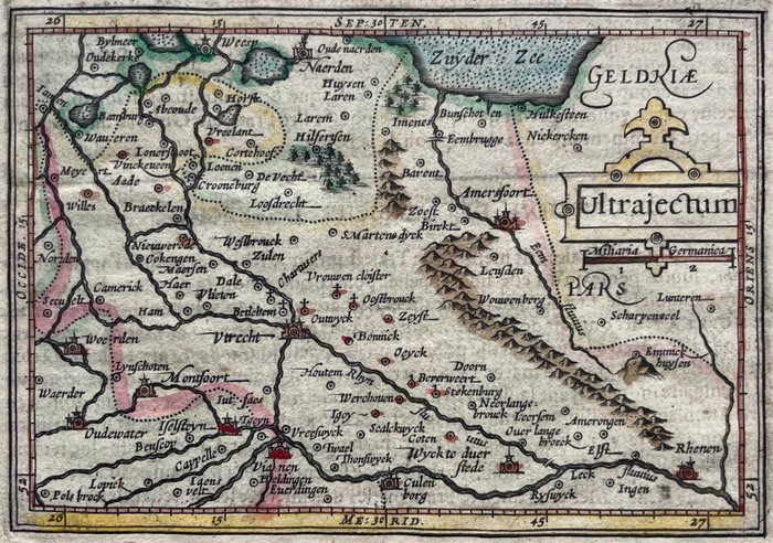
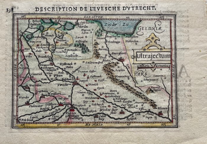
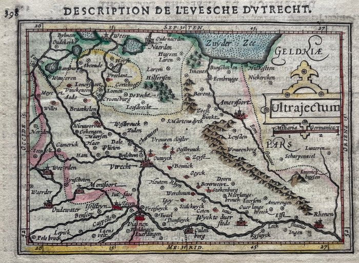
Map of Utrecht Province, 17th Century

2 EUR
Details
Date:
16/10/2024
Material:
Paper
Farve:
Blue, Green, Brown
Description from the seller
Map of Utrecht Province, 17th Century
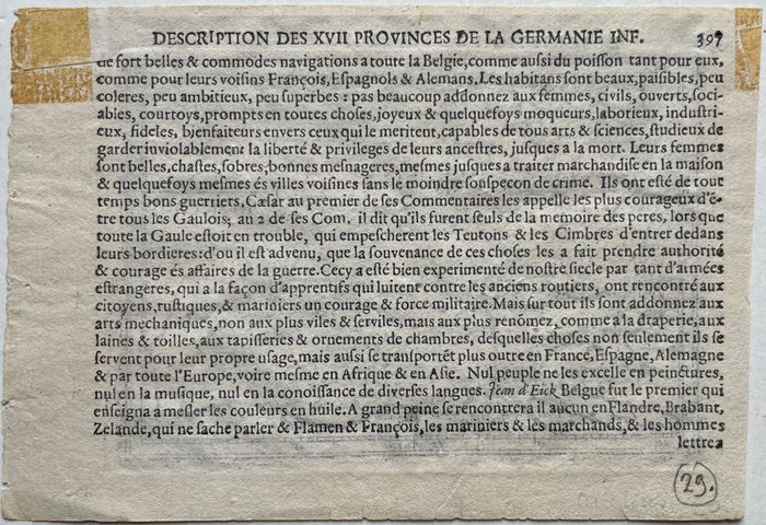
Meget tidligt kort over provinsen, eller bispedømmet i Utrecht efter en original af Petrus Bertius, i: 'Caert-Thresoor', Middelburg, Barent Langenes, 1598. Fortsat af Jodocus Hondius Jr., efter 1598, som tilføjede bredde- og længdegrad. Her i en fransksproget udgave med titlen øverst: 'Description de l'Evesche d'Utrecht', udgivet af Wohl, efter 1616. Fremragende stand, helside 12x17,5 cm., billedstørrelse 10x13,4 cm., med fulde brede marginer, gammeldags håndfarvet, verso: 'Description des XVII Provinces de la Germanie Inf.' på fransk.
Paper
KORT
Blue
Green
Brown
Amount: 1
mål: 12 x 17.5 cm
Related products
Related products
Related products
Related products
Related products
Related products
Related products
Related products
Related products
Related products
Related products
Related products
