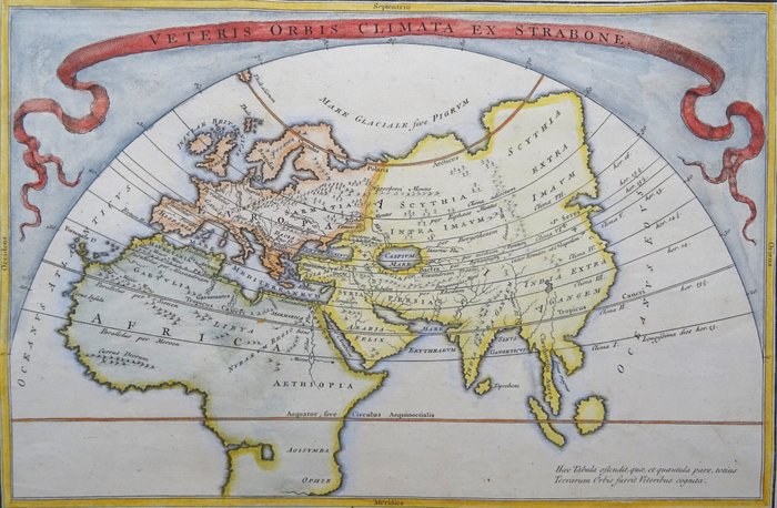

Antique World Map by Cellarius - Veteris Orbis Climata ex Strabone

Details
Description from the seller
Antique World Map by Cellarius - Veteris Orbis Climata ex Strabone
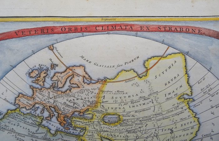
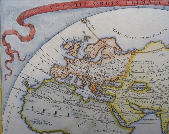
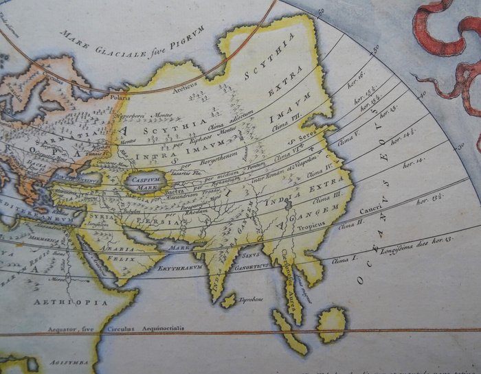
Veteris Orbis Climata ex Strabone (1742) Antikke verdenskort af Cristopher Cellarius, baseret på Strabos arbejde. Afrikas sydspids er ikke blevet opdaget. Japan, den koreanske halvø, Australien eller Oceanien er ikke indlysende. Fremragende billede af sejlruten, der forbinder Atlanterhavet med Stillehavet langs Ruslands kyst (nordøstpassagen). Verden er mærkeligt nok opdelt i syv klimazoner. Fra en 1742-udgave af 'Notitia Orbis Antiqui, Sive Geographia Plenior...et Novis Tabulis Geographicis' af Cellarius, som blev udgivet i London, Amsterdam og andre steder i løbet af de næste 100 år og var en af de mest populære antikke geografier i din tid . Mål: 20x30,5 cm (25x35,5 cm) Flot stand, blank bagside Referencer: McCorkle (18th C. Geography Books) #211-1; Shirley (BL Atlas) T.CELL-4a #1.
